The Marmotte GranFondo Pyrenees challenges its elder brother in the Alps for the title of the toughest one-day sportive. At 165km and 5,500m+, the least we can say is that the organisers didn’t miss the mark!
In alternate years, the Marmotte Pyrenees either starts in Luz Saint Sauveur and finishes at Hautacam, as it did in 2019, or starts in Argelès-Gazost and finishes at Luz Ardiden, as it will in 2020. In either case, the distance and climbing is almost identical.
With a double ascension of the Tourmalet, punctuated by the Hourquette d’Ancizan and the col d’Aspin, followed by a summit finish at either Hautacam or Luz Ardiden, there is very little flat. The descents are steep and fast, giving little time to recover between the unremitting climbs.
Note that the event is timed from start to finish – there are no neutralised sections – and the roads are completely open to normal traffic.
In 2018, the first rider took just under 6 hours and the last person to finish came in at just under 13 hours. Even in the best weather conditions, this will be a seriously hard day on the bike.
Here is what our Pyrenees specialist Yannick has to say about the course:
“I think it’s a little crazy, and you have to be a bit mad and a genuine cyclist at heart to launch off into this ordeal. To suffer and to enjoy the suffering, to take pleasure in exhausting yourself on your bike, to love the mountains, to pick up the gauntlet, to go beyond your limits – these are the essentials you must know before taking your place on the start line.
The Marmotte forces you to respect it. Whatever you do, don’t under-estimate the challenge! In spite of the best possible training and preparation – which are completely indispensable – you will have to tackle this succession of climbs at a pace well below your capacity to hope to go the distance, and perhaps to feel good on the final climb.
To be able to control your impulses, to be modest before the mountain, above all not to get carried away by the excitement of the first climb, to keep something in reserve. These are not easy, especially when other riders are overtaking you and you know you could go faster. They are however essential to obtain the Holy Grail: enjoy the ride from start to finish.”
– Yannick Drangowski
(Coach Alpine Cols, ex-Cat 1 rider with Occitane Cyclisme Formation)
Read on for our course description and our tips for making the most of your ride.
The start in Argelès-Gazost
The start is near the Casino and its historic park. Leaving the town, we head south by the shortest route to the col du Tourmalet. The first 8km are on the floor of a wide valley. The road is good and the peloton will quickly string out as the leaders set the pace. The valley then narrows dramatically and the road becomes more sinuous and climbs gently as it follows the river to Luz Saint Sauveur and the start of the climb to the Tourmalet.
Tips for this section:
- These first 18km will serve to warm up the legs and settle into the rhythm of the race before the climb.
- Don’t burn any matches needlessly: there’s a very long way to go!
THE TOURMALET FROM LUZ SAINT SAUVEUR
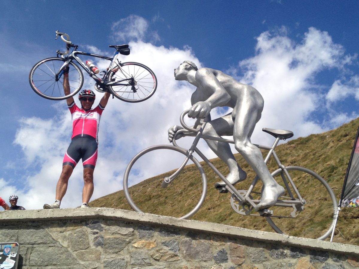
We’ve written extensively about the col du Tourmalet (2,117m) elsewhere. Certainly the most famous climb in the Pyrenees, the col has also been used more often by the Tour de France than any other. Long and difficult, it merits its legendary status.
The climb starts in Luz Saint Sauveur and reaches the summit after 18km and 1,404m of climbing at an average gradient of 7.4%. The average is misleading, because the road includes pitches that are almost flat and others at more than 13%. The engineers that constructed the road obviously enjoyed a joke, because the steepest part comes at the end!
As you leave Luz Saint Sauveur the road stretches out far ahead, rising relentlessly. This is going to be long. Settle into a rhythm, turn the pedals as smoothly as possible, try to keep your heart rate down. The gradient changes imperceptibly, sometimes a little steeper, sometimes a little easier, making the rhythm hard to find.
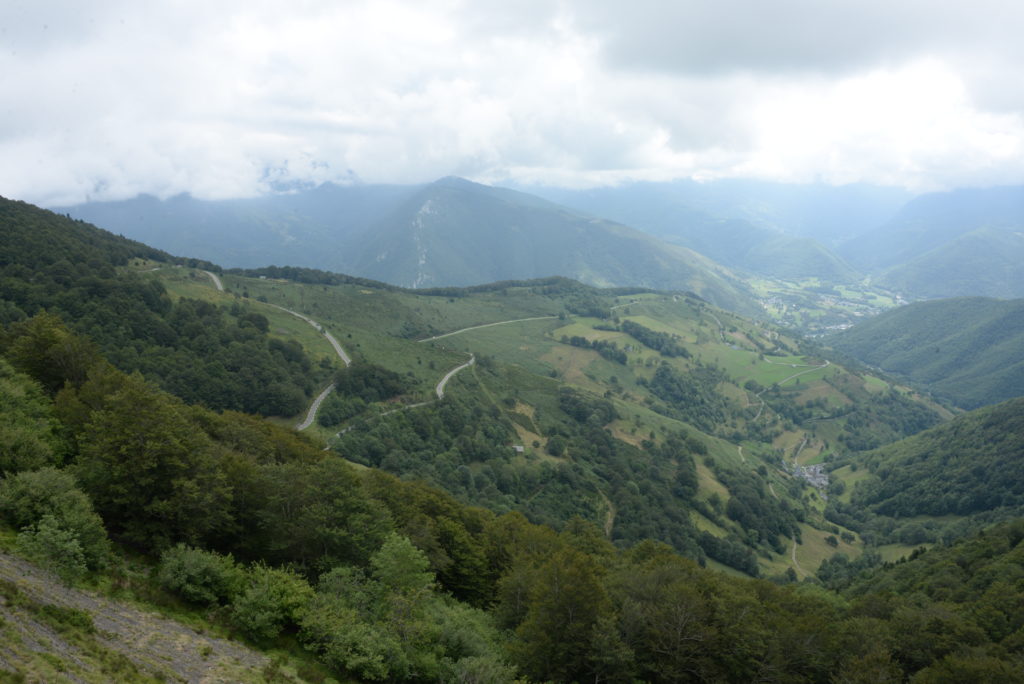
After about 4 kilometres the monotony is broken by the first of two sets of short hairpin bends. Soon after the second set of hairpins you reach the village of Barèges, followed by an unwelcome surprise as the road steepens to over 13% for a few hundred metres. If you have judged your pace correctly, you will start to overtake other cyclists at this point.
It remains steep for the next kilometre before levelling off to an easy section near the ski station car park. You can now see the head of the valley and can imagine where the col must be, impossibly higher up what looks like a sheer rock face. The road leads on straight towards it. 8 km left to climb, with nothing less than 7.5%.
The road makes a big loop around to the right, climbing steeply again, and you pass the Super-Barèges ski station. You will be standing more and more often on the pedals, as the gradient approaches 10%. There are still 4 km left to climb.
3km to go. Another long straight, this one cut into the rock face, before the road curves around to the left and winds up slowly towards a right hand hairpin. The valley is now laid out below and you will see a long line of riders behind you inching their way painfully towards the col.
The road is steep and never ending. You can’t see the summit any more. The road disappears around a left hand bend. You count the pedal strokes. When you finally reach the bend, you can see the last hairpin in front. Glancing up to your left the summit seems to hang vertically above you.
One down, four to go! Look out for the llamas blocking the road as you cross the summit.

Tips for this section:
- You must earn the right to cross the Tourmalet, with between 1h10 and 2h30 of hard work required to reach the summit. Remember you will do it twice today: it would be smart to take it easy the first time up.
- The single most important piece of advice is this: from the start of the Tourmalet onwards, set your own pace at your own rhythm and ignore anyone that overtakes you. You will achieve your best time by keeping a constant level of intensity on all the climbs, which total more than 77km. Each cyclist starts with a certain size of reservoir of glycogen, and the harder you ride the quicker it depletes. It would be a pity to use half of it on the first 10km out of 77 in total!
- If you have a power meter, stick to your target power output and don’t be tempted to push 10W or 20W harder. If not, watch your heart rate to stay in the correct zone or rely on your sensations: you should be able to talk easily enough in short sentences. If you can’t speak, you are going too hard.
DESCENT TOURMALET TO SAINTE-MARIE DE CAMPAN
The descent to Sainte-Marie-de-Campan is on a wide road with fairly good visibility (at least in fine weather). It is straight for long sections and the tarmac is usually in good condition, thanks to the Tour de France! However, it is steep, very fast and as a result quite dangerous, even without the frequent appearance of livestock on the road.
The gradient eases off for the last 4km as it approaches Sainte Marie de Campan, the famous village where Eugène Christophe stopped at the blacksmith’s to repair his forks in 1913.
Tips for this section:
- You will need to stop at the feed station on the Tourmalet to pick up water and perhaps something to eat.
- Don’t hang around to get cold: put on gilet and arm-warmers or a jacket and start on down without delay.
- You must concentrate and keep your wits about you during the descent, which is very fast and dangerous.
- There will be very little time to recover. Keep pedalling during the descent in order to evacuate the toxins accumulated during the climb.
- The last 4km provide the best opportunity to eat and drink in relative safety.
LA HOURQUETTE D’ANCIZAN FROM SAINTE-MARIE DE CAMPAN
There is not a metre of flat at the end of the descent before starting up the valley to the Hourquette d’Ancizan (1,564m). From Sainte Marie de Campan the road is a real leg-breaker, with a succession of short steep sections over the 7km to Payolle, a small ski station where we fork right off the main road and begin the real climb.
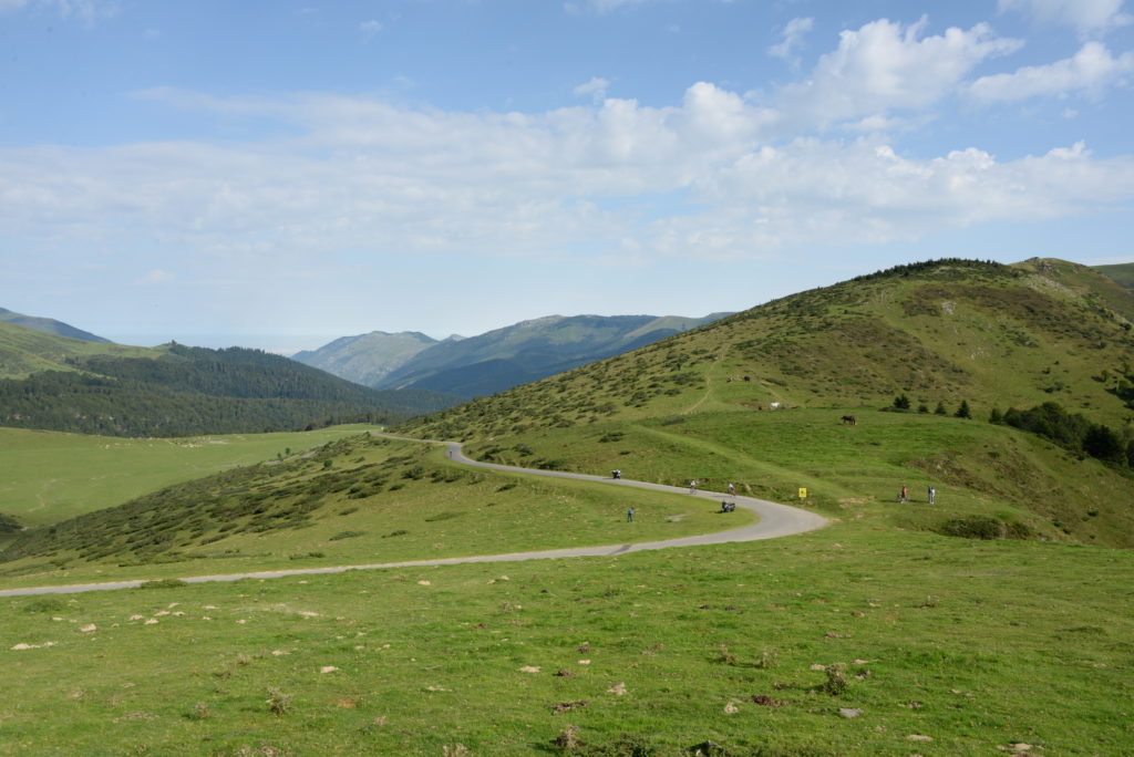
The final 10km of the climb to the Hourquette are beautiful. It is mostly in a forest, on a narrow road, and feels quite wild. It is not unusual to have to slalom between livestock while fighting with the slope. Like many climbs in the Pyrenees, it is very irregular. There is even a short descent near the top, followed by a final 2.5km to climb around a majestic bowl with fantastic views across the valley.

Tips for this section:
- Ride in a group up the valley from Sainte Marie de Campan to Payolle, but beware being forced to go too hard on the steeper sections. Better to drop back than dig too deep at this early stage.
- Use your derailleur as often as needed to keep in the right range of cadence and power output. If it feels hard, it is probably too hard: there’s still a long way to go.
- Keep eating and drinking regularly during the climb.
DESCENT HOURQUETTE D’ANCIZAN TO CADEAC
The descent is on a narrow road which is not always in the best condition. Some of the bends lack visibility and tighten dangerously: the descent can quickly become an ordeal if you are flagging by this point.
At the bottom there are another 5km of gentle descending to ride in the valley before starting up the col d’Aspin. The second feed station is in the middle of this gentle descent, at Cadéac.
Tips for this section:
- If you are keen to get a good time there’s no time to admire the views. Keep the pressure on over the top, but beware the dangerous descent!
- Drink what’s left in your water bottles before you get to Cadéac.
- Stopping at the feed station here is essential: the next one is back on the col du Tourmalet!
COL D’ASPIN FROM ARREAU
The climb to the col d’Aspin (1,489m) starts with a left turn at the exit of the village of Arreau. The road winds up for 12km and 780m+ through a series of hairpins. The average gradient is 6.5% and the maximum 10%. The last half is significantly steeper than the first half, so be prepared for a change of rhythm at the 6km mark.
At this point you will be approximately half-way to the finish line.

Tips for this section:
- Once again, take the climb at a steady pace. Avoid any efforts that might put you in the red.
- Keep feeding the machine!
DESCENT ASPIN TO SAINTE-MARIE DE CAMPAN
Once over the top it is a fast, windy descent down to Payolle where you will rejoin the road you came up earlier from Sainte Marie de Campan, now a false flat descent. Many riders will push on fast and pedal hard on the flatter sections.
Tips for this section:
- If you have the legs and feel good you should try to join a group and ride this at a decent pace, but without ever going in the red.
- In every case it is vital to eat, drink and spin your legs to prepare for the second climb to the Tourmalet.
- Avoid free-wheeling at all costs, even if you feel very tired: this just allows the lactate to stagnate in your legs.
TOURMALET FROM SAINTE-MARIE DE CAMPAN
The climb is a little shorter from this side, rising 1,268m over 17km, at an average gradient of 7.4% (but with a few sections at more than 13%).
Until the bleak and unlovely ski station of La Mongie at 5km from the summit the road is mostly straight (with a few wiggles) and can seem interminable. From here on the monotony is broken by a series of hairpin bends and one can see the summit high above.
Tips for this section:
- For any decent climber it is not the mountain itself that causes trouble, it is the accumulated fatigue, the weather conditions on the day and above all what happens in the race itself that makes a difference. The pace you ride at dictates how hard the climb is on any one particular day, and if you have ridden too hard until this point, you are in for a long and painful struggle to reach the summit.
- Keep to a steady endurance pace and spin your legs as easily as you can.
DESCENT TOURMALET TO LUZ SAINT SAUVEUR
You will recognise the descent of course from your earlier climb. Only a few hours ago? For some, this will feel like a lifetime!
The first 4km to the ski station are steep and windy, followed by a long straight punctuated only by the hairpins after Barège. This is an extremely fast descent.
The final feed station is in Luz Saint Sauveur. From here you should expect to take between one and two hours more to reach the finish, depending on your level and how tired you are.
Tips for this section:
- Once again the danger on the descent comes mainly from the speed and the possibility of livestock on the road: BE CAREFUL!
- Turn the pedals to help your legs recover as much as possible, and remember to eat and drink whenever it is safe enough to do so. There’s one last challenge to come, and it is not the least!
- Stop at the final feed station and make sure you have enough food and drink to reach the finish, 1,010m higher up.
LUZ ARDIDEN
The climb to Luz Ardiden (1,720m) is not to be underestimated. There are 14.7km and 1,010m between you and the finish line (just like Alpe d’Huez…). It may seem easy on paper after all those hard months of intense training, and after what you have already ridden today, but in reality it will be extremely challenging!
Like most climbs in the Pyenees, the gradient is irregular and it is hard to keep any sort of rhythm. The slope varies from 5% to 10%. You will have to keep using the derailleur and stand up on the steeper sections, especially in the middle. Those who know the climb well will be at a distinct advantage.
Tips for this section:
- If you have paced yourself well throughout the ride and done a good job of eating and drinking what you need, you should be able to increase the pace slightly and finish on a high, overtaking dozens of other riders in the last few kilometres!
- For many, the challenge on this final climb will be as much mental as physical and you will need to force your legs to keep turning when all you want to do is stop.
- Mental games such as setting small goals, using mantras or otherwise distracting yourself can be helpful.
EQUIPMENT
For all but the very strongest riders, we recommend a compact chain-set 50-34 and the widest possible cassette, such as an 11-32 or better.
Make sure your bike is thoroughly checked over and in perfect condition before the start.
Come prepared for all weathers. The northern Pyrenees are close to the Atlantic and bad weather frequently blows in from the Bay of Biscay, shrouding the Tourmalet in mist and rain. Equally, it can be extremely hot.
PREPARATION FOR THE MARMOTTE
If you want to give yourself the best shot at doing well at the Marmotte next year you should consider joining an Alpine Cols coaching camp. These are very different from your typical “training camp”, where the focus is simply on distance and climbing.
At an Alpine Cols coaching camp the focus is on technique. Cycling is a highly technical sport and the potential benefit from coaching is enormous. Amongst many other skills, we will teach you to climb powerfully but economically, to descend fast but safely, to pace yourself over many hours in the mountains and to feed and hydrate yourself optimally throughout.
Check our coaching camps calendar or contact us for more information.